VOLUME 17 (Supplement)

SciEnggJ 17 (Supplement) 268-280
available online: July 22, 2024
DOI: https://doi.org/10.54645/202417SupLOF-25
*Corresponding author
Email Address: fbpulhin@up.edu.ph
Date received: March 8, 2024
Date revised: April 26, 2024
Date accepted: April 29, 2024
ARTICLE
Land cover change and carbon loss: A case study of the Pagsanjan-Lumban and Baroro watersheds in Luzon, Philippines
Resources (CFNR), University of the Philippines Los Banos
(UPLB), College, Laguna, Philippines
2Interdisciplinary Studies Center for Integrated Natural Resources
and Environmental Management, University of the Philippines,
Los Baños, Laguna
3Institute of Renewable Natural Resources, UPLB-CFNR, College,
Laguna, Philippines
4Department of Social Forestry and Forest Governance, UPLB-
CFNR, College, Laguna, Philippines
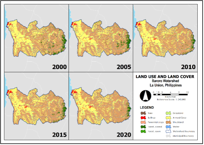
The unequivocal increase in global surface temperature underscores the urgency to take drastic actions to halt the continuous accumulation of greenhouse gases (GHGs) in the atmosphere. One of the top five sectors contributing to global GHG emissions is agriculture, forestry, and other land uses (AFOLU). Despite being a significant carbon source, the FOLU sector is also a substantial carbon sink. Like other tropical countries, the Philippines' FOLU sector, particularly the watersheds, has great potential to store significant amounts of carbon. However, these watersheds experience land cover change over time, affecting their carbon storage capacity. This paper analyzes the land cover change in the Pagsanjan-Lumban Watershed (PLW) and Baroro Watershed (BW) in the Philippines from 2000 to 2020, assesses the impact of these changes on the amount of carbon stored, estimates the economic value of carbon sequestration, and recommends measures to enhance the role of the two watersheds in climate change mitigation. Google Earth Engine was used to classify a collection of remotely sensed optical and radar-derived terrain rasters into land use and land cover (LULC) maps, while Integrated Valuation and Ecosystem Services and Tradeoffs (InVEST) software estimated the carbon stocks of the watersheds. In addition, the social cost of carbon (SCC) was employed to provide economic insights into future climate change impacts of current carbon emissions. Results revealed that the total estimated carbon stocks in 2020 in the PLW and BW are 6.41MtC and 2.01 MtC, respectively. An overall decline in carbon sequestration in both watersheds was observed over the two-decade period, and it was primarily due to forest cover reduction for urban and agricultural expansion. PLW exhibited an overall economic benefit, while BW faced economic costs associated with land cover changes. These findings highlight the influence of watershed management on carbon storage capacity; hence, developing site-specific strategies through appropriate management measures and interventions is critical to increasing or at least recovering its former carbon stock potential. The research output can be an effective additional input in spatial planning and decision-making in the study sites.
© 2025 SciEnggJ
Philippine-American Academy of Science and Engineering